Heu oblidat la contrasenya? Nou usuari? Registrar
Whale Shark, Philippines. Photo by Stephane Rochon.
Gaudiu i participeu!
| Trobeu els millors llocs d'immersió |
|
|
 Útila Island
Honduras, Bay Islands
English (Traduiu aquest text en Català): Útila (Isla de Útila) is the third largest of Honduras' Bay Islands, after Roatán and Guanaja, in a region that marks the south end of the Mesoamerican Barrier Reef System, the second-largest in the world. The eastern end of the island is capped by a thin veneer of basaltic volcanic rocks, erupted from several pyroclastic cones including 74 m (243 ft) Pumpkin Hill which forms the highest point on the island. It has been documented in history since Columbus' fourth voyage, and currently enjoys growing tourism with emphasis on recreational diving.
Més detalls
| Jan | Feb | Mar | Apr | May | Jun | Jul | Aug | Sep | Oct | Nov | Dec | |
|---|---|---|---|---|---|---|---|---|---|---|---|---|
| Climate | ||||||||||||
| Air temp. | ||||||||||||
| Water temp. | ||||||||||||
| Equipment | Keine Ahnung | Keine Ahnung | Keine Ahnung | Keine Ahnung | Keine Ahnung | Keine Ahnung | Keine Ahnung | Keine Ahnung | Keine Ahnung | Keine Ahnung | Keine Ahnung | Keine Ahnung |
| Best season | ||||||||||||
Aquest és un mapa interactiu! Empreu els controls per desplaçar i ampliar aquest mapa.
- registres d'immersió (0)
- viatges (0)
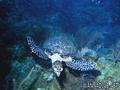
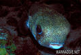
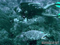
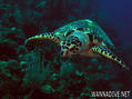
- Fotos (9)
- Vídeos (0)
- Compartir
- Favorit
-
Les vostres llistes de favorits i de futurs llocs d'immersió
Llocs d'immersió
| Llocs d'immersió (21) | Qualitat | Profunditat mitjana | Profunditat màxima | Experiència | Tipus d'immersió | ||
|---|---|---|---|---|---|---|---|
| Airport Caves | - / - | 10 m | 18 m | Tots els submarinistes | 
|
||
| Aquarium | - / - | 15.2 m | 18.3 m | CMAS * / OW |
|
||
| Black Corral Wall | - / - | 4.6 m | 39.6 m | Tots els submarinistes | 

|
||
| Black Hills | 3 / - | 12 m | 30 m | Tots els submarinistes | 

|
||
| Blackish Point | - / - | 15 m | 26 m | Tots els submarinistes |
|
||
| CJ's Dropoff | - / - | 15.2 m | 36.6 m | Tots els submarinistes |
|
||
| Duppy Waters | 1 / - | 15 m | 30 m | Tots els submarinistes |
|
||
| Eagle Ray Alley | - / - | 15 m | 24 m | Tots els submarinistes |
|
||
| Great Wall | - / - | 20 m | 29 m | CMAS * / OW |
|
||
| Halliburton | 2 / - | 27 m | 31 m | Tots els submarinistes | 
|
||
| Jack's Bight | - / - | 6.1 m | 19.8 m | CMAS * / OW |
|
||
| Little Bight | - / - | 7 m | 30 m | Tots els submarinistes |
|
||
| moon hole | - / - | 4.6 m | 24.4 m | Tots els submarinistes |
|
||
| Old House | 2 / - | 15 m | 40 m | Tots els submarinistes |
|
||
| Raggedy Cay | - / - | 15 m | 30 m | Tots els submarinistes |
|
||
| Ships Stern | - / - | 15 m | 25 m | Tots els submarinistes | 
|
||
| Silver Garden | - / - | 9.1 m | 36.6 m | Tots els submarinistes |
|
||
| Sting Ray Point | - / - | 15.2 m | 23.2 m | Tots els submarinistes | 
|
||
| Ted's Point West | - / - | 15.2 m | 18 m | Tots els submarinistes |

|
||
| The Maze | - / - | 15 m | 40 m | CMAS * / OW |
|
||
| Utila Open Water | 1 / - | 3 m | 15 m | Tots els submarinistes | 
|
 Comentaris
Sigueu el primer a comentar aquest país
Errors, comentaris
Podeu editar aquesta pàgina per corregir errors o afegir nova informació. Si teniu cap problema en relació a aquesta pàgina, Envieu comentaris.