Localització: Northern Asia (the area west of the Urals is considered part of Europe), bordering the Arctic Ocean, between Europe and the North Pacific Ocean
Coordenades geogràfiques: 60° 0' N, 100° 0' E
Km de costa: 37,653 km km
Clima: ranges from steppes in the south through humid continental in much of European Russia; subarctic in Siberia to tundra climate in the polar north; winters vary from cool along Black Sea coast to frigid in Siberia; summers vary from warm in the steppes to cool along Arctic coast
Terreny: broad plain with low hills west of Urals; vast coniferous forest and tundra in Siberia; uplands and mountains along southern border regions
Elevació: lowest point: Caspian Sea -28 m
highest point: Gora El'brus 5,633 m
Perills naturals: permafrost over much of Siberia is a major impediment to development; volcanic activity in the Kuril Islands; volcanoes and earthquakes on the Kamchatka Peninsula; spring floods and summer/autumn forest fires throughout Siberia and parts of European Russia.
Moneda: Russian ruble (RUR)
Població: 141,377,752 (July 2007 est.)
Idiomes: Russian, many minority languages
Capital: Moscow
Divisions: 12 regions: Central, Central Black Earth, East Siberian, Far Eastern, Northern, North Caucasus, Northwestern, Volga, Urals, Volga-Vyatka, West Siberian, Kaliningrad
Mapa addicional

Aquest és un mapa interactiu! Empreu els controls per desplaçar i ampliar aquest mapa.
La vostra zona favorita no és a la llista? Afegir una zona
Zones
El vostre lloc d'immersió favorit no és a la llista? Afegiu un lloc d'immersió
Llocs d'immersió
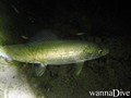
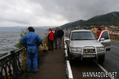
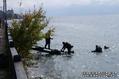
| Llocs d'immersió (8) |
|
 |
Qualitat |
Profunditat mitjana |
Profunditat màxima |
Experiència |
Tipus d'immersió |
| Bungur Black island |
- / - |

|
|
49.2 ft |
131.2 ft |
Tots els submarinistes |

|
| Ingol' Lake |
2 / - |
|
|
65.6 ft |
308.4 ft |
Tots els submarinistes |


|
| Konopelka |
2 / - |
|
|
29.5 ft |
49.2 ft |
Tots els submarinistes |
|
| Lake Teletskoye |
- / - |
|
|
23 ft |
1066.3 ft |
Tots els submarinistes |

|
| Lake Vad |
5 / - |
|
|
ft |
ft |
Tots els submarinistes |
|
| Oazis |
3 / - |
|
|
29.5 ft |
42.7 ft |
CMAS * / OW |

|
| Temir |
3 / - |
|
|
131.2 ft |
328.1 ft |
Tots els submarinistes |

|
| Zaboy |
3 / - |
|
|
16.4 ft |
26.2 ft |
CMAS * / OW |
|
 Comentaris
Mostrar tot (0)...
Sigueu el primer a comentar aquest país
Errors, comentaris
Si voleu afegir nova informació o heu trobat errors sobre aquest país, Envieu comentaris.
Wannadive.net 24/24
Wannadive.net al teu mòbil

Butlletí Totes les notícies per correu electrònic
 Russia